
Wed 16 September 2026
Local News | El Niño 2026: What Could It Mean for Spain and the Costa Blanca This Autumn?
El Niño is strengthening in 2026. We look at the latest NOAA and AEMET forecasts and what they could mean for Spain and the Costa Blanca this autumn.

El Niño is strengthening and weather experts are watching closely
As summer draws to a close in Spain, attention is beginning to turn towards the weather we could experience during autumn and winter.
One of the biggest talking points in global weather forecasting at the moment is El Niño. According to the latest update from the US National Oceanic and Atmospheric Administration, NOAA, El Niño is already present and is continuing to strengthen.
Its latest assessment, issued on 13 August 2026, says there is now a greater than ninety percent chance of a very strong El Niño developing during autumn and winter 2026 to 2027. NOAA has even calculated a sixty nine percent probability that the event could reach exceptional strength between October and December.
But what exactly does that mean, and should those of us living in Spain and on the Costa Blanca expect an unusually wet or stormy autumn?
What is El Niño?
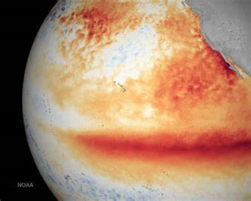
El Niño is a naturally occurring climate pattern involving unusually warm sea temperatures across parts of the tropical Pacific Ocean.
Although this happens thousands of kilometres away from Spain, changes in Pacific Ocean temperatures can alter atmospheric circulation around the world. This can influence temperatures, rainfall patterns and storm tracks across different continents.
El Niño is therefore an important tool for long range climate forecasting, but it is important to understand that it does not determine the weather on any particular day or guarantee a specific type of winter in Spain.
Spain's climate is affected by many other atmospheric patterns, particularly those developing over the Atlantic and Mediterranean.
So, does El Niño mean more rain in Spain?
The answer is not quite as simple as some headlines might suggest.
There is evidence of a relationship between El Niño and rainfall across parts of the Iberian Peninsula, particularly during certain stages of autumn and winter. Previous research discussed by AEMET has found links between El Niño conditions and increased autumn rainfall in parts of the western Mediterranean.
However, AEMET also stresses that the connection between El Niño and European weather can change considerably depending on the season and on other atmospheric conditions.
Research into rainfall across Spain also shows that Mediterranean weather patterns have a particularly strong influence on the eastern side of the country, including the Valencia region. This means conditions closer to home can be more important in determining whether areas such as Jávea receive heavy rainfall.
In other words, a strong El Niño can influence the bigger picture, but it cannot tell us whether Jávea will experience a major storm on a particular week.
What is AEMET forecasting for Spain?
There is another reason autumn 2026 is attracting attention.
AEMET's current seasonal forecast for August, September and October 2026 gives a very high probability that average temperatures will fall within the warmer than normal category across the whole of Spain.
More interestingly, AEMET also indicates a high probability of rainfall falling within the wetter than normal category across most of Spain, with the exception of the northwest of the peninsula and the Canary Islands.
The agency specifically says this wetter signal is partly linked to the possibility of individual convective weather episodes, particularly during August and September.
That does not mean it will rain constantly.
Seasonal forecasts deal with averages and probabilities rather than predicting individual storms months in advance. Spain could therefore experience long periods of warm and settled weather interrupted by comparatively short but intense periods of rain.
AEMET's shorter term outlook also makes clear that uncertainty increases considerably the further ahead weather models attempt to forecast.
What about the Costa Blanca?
Autumn is already one of the most important periods of the year for weather watching along Spain's Mediterranean coast.
The sea remains very warm after the summer while cooler air can begin arriving at higher levels of the atmosphere. Under the right circumstances, this combination can contribute to powerful thunderstorms and exceptionally heavy rainfall.
Residents of the Costa Blanca will be familiar with the term DANA, which describes an isolated depression at high altitude that can sometimes produce severe weather.
However, it would be incorrect to say that El Niño itself causes a DANA.
The development and location of these events depends on atmospheric conditions over Spain and the Mediterranean at the time. El Niño may form part of the much wider global climate background, but it is not a direct forecast of a Costa Blanca storm.
A warmer autumn remains likely
Perhaps the clearest message from the current Spanish forecast is actually temperature rather than rainfall.
AEMET currently sees a very high probability of above normal average temperatures throughout Spain for the August to October period when compared with the 1991 to 2020 climate reference period.
This continues a broader pattern of unusually warm conditions. The previous winter of 2025 to 2026 was already one degree Celsius warmer than the 1991 to 2020 Spanish average and became the ninth warmest winter since national records began in 1961.
For those of us on the Costa Blanca, that could mean summerlike conditions continuing well into the traditional autumn season, even if periods of unsettled weather also develop.
Should homeowners be concerned?
At this stage, there is no reason to assume that Spain or the Costa Blanca is heading for a particular extreme weather event simply because El Niño is strong.
It is, however, sensible for homeowners to prepare for the normal Mediterranean autumn weather season.
Checking exterior drainage, clearing gutters, making sure terraces and balconies can drain properly and securing outdoor furniture before forecast storms are all straightforward precautions.
For properties that are left empty for periods of time, it can also be worth arranging for someone locally to check the property following particularly heavy rain.
What happens next?
Meteorologists will be watching El Niño closely over the coming months.
NOAA's current forecast suggests it could continue strengthening towards the end of 2026, while AEMET will continue updating its seasonal outlook for Spain each month.
The key thing to remember is that seasonal weather forecasts describe probabilities, not certainties.
El Niño may increase the likelihood of certain weather patterns around the world, but here in Jávea and across the Costa Blanca, local Mediterranean and Atlantic conditions will ultimately determine what weather arrives.
For now, the indications point towards a warmer than usual start to autumn, together with the possibility of periods of above normal rainfall across much of Spain.
And as anyone who has spent an autumn on the Costa Blanca knows, blue skies and sunshine can still be followed surprisingly quickly by a spectacular Mediterranean storm.